Support The Royal Canal Deep Sink Route Proposal
Dublin’s Royal Canal Greenway Needs Your Support!
The proposed routing for the Royal Canal Greenway in the ‘Deep Sink’ section between Castleknock and the Kildare border, is out for public consultation till this Wednesday 27th March. It needs your support as opposition to this wonderful proposal is mounting locally. Please send in your voice of support for this proposal NOW! Feel free to use any or all of the submission below from Dublin Cycling Campaign. Submissions ca be made via the Fingal County Council website at https://consult.fingal.ie/en/consultation/royal-canal-urban-greenway-pub…
Royal Canal Greenway, 12th Lock to Kildare Border - Fingal County Council
1.0 Introduction
Dublin Cycling Campaign is the leading member of Cyclist.ie, the Irish Cycling Advocacy Network (ICAN), the federation of Cycling Advocacy Groups, Greenway Groups, and Bike Festivals on the island of Ireland. Cyclist.ie is the Irish member of the European Cyclists’ Federation (www.ecf.com). Our vision is that cycling will be a normal part of transport and everyday life in Ireland.
We commend Fingal CC for its attempt to display the proposals digitally using aerial photo/satellite imagery. This can help the ordinary user to possibly identify the locations more easily. However, this methodology has made the loading of the final maps and designs a much slower process, compared to the normal digital technical drawings. It is though, disappointing that there are no location specific photo-montages supplied, as part of this ‘engagement’. The animated cross sections give a rough idea of what is proposed, but these need to be amplified by realistic scaled cross sections and photo montages. In particular there are not even basic details of the proposed bridge at Castleknock.
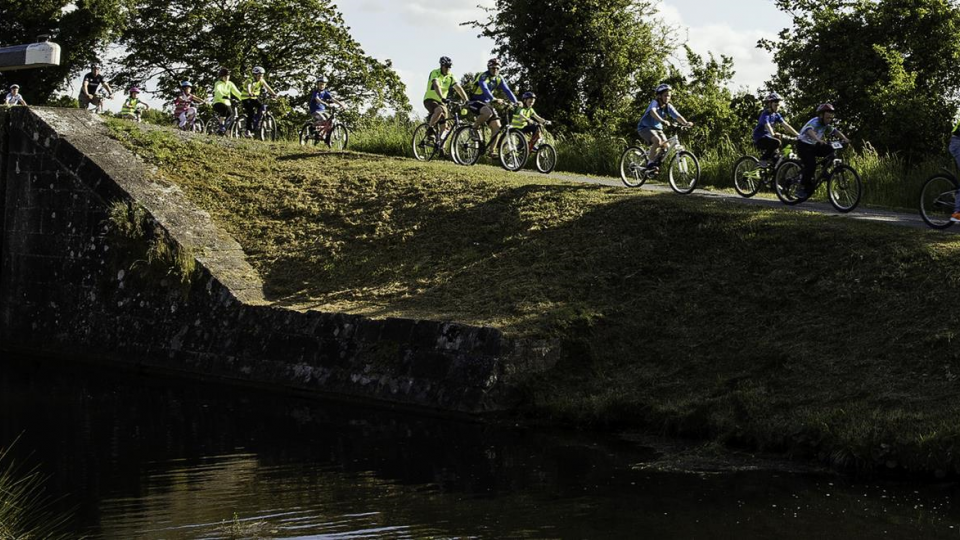
Dublin Cycling Campaign/Cyclist.ie are delighted to see this Royal Canal greenway proposal from Fingal Council progressing, following a very long gestation, and numerous design changes. We are generally happy with the emerging preferred route, but await further details as the route develops, particularly in relation to environmental effects of the proposals. This Greenway Route has the potential to provide a relatively high-quality, safe, walking and cycling path for commuters, local residents, and visitors alike, and will ultimately link up with Greenway and commuter routes eastwards into Dublin City and westwards to the River Shannon. It is bound to encourage greater active commuter travel by bike, will undoubtedly attract more visitors to the area, and on its eastern end will serve as a commuter cycle route to and from a number of high employment locations in West Dublin and Dublin City.
We note that the present consultation phase is designated as ‘Public Engagement on Emerging Preferred Route’. We assume that this is a non-statutory consultation, as part of a longer process? It is unclear to us what further phases will take place in the route development process, and public consultation. It would be useful to know what Fingal CC’s projected development process is at this late stage, and an approximate timeline for the full development of this critical commuter and tourist route.
We also have a number of specific queries and issues, which we outline below in subsequent sections.
2.0 General Comments
2.1 Route Width
The present agreed TII Guidance/Standard for Irish Cycle Routes is ‘Rural Cycleway Design - DN-GEO-03047’. This Standard recommends in Table 4.1 a Minimum (our emphasis) width of 3 metres for a low volume cycle route and 5 metres for a high volume route. There is no doubt that the likely usage/demand on this route will be high, as it will open up greater commuting options, as well as significant leisure travel opportunities, and is generally very close to dense housing estates. The construction of this commuter/leisure Greenway, will undoubtedly attract increasingly large numbers of cyclists and must be designed accordingly to meet this undoubted growth in demand. This route should have a minimum desired width standard of at least 4 metres, and only be reduced to 3 metres in areas of constraint. It should be aiming for 5m wherever possible especially closer to built up areas from Clonsilla onwards into the city centre. We urge Fingal County Council to work to maximise the route width on this proposed shared route or use a segregated path design, such as employed by Dublin City Council in the design of the Route closer to Dublin City - see below. In the more high volume locations, such as between the 12th Lock and Diswellstown Road/Dr Troy Bridge, the design team might consider an alternate to the standard shared pathway. A segregated path design, with the cycle track at a lower level than the footpath would reduce conflicts in the more high volume area.
2.2 Access and Road Crossing Design Details
There are no details supplied for access gates on to the route. While we might assume that any proposed access gates will, at the very least, comply with the recommended design given in Rural Cycleway Design - DN-GEO-03047, this cannot be ascertained from the posted documentation and hopefully will become clearer at the more detailed design stage. Dublin Cycling Campaign favours clear unobstructed access. Photo montages of any proposed access gates would be particularly useful, as connections and road crossings all along the route, raise a number of fairly standard safety issues.
For instance, the roadway and bridge crossing at Castleknock is particularly challenging due to relatively heavy traffic levels, fast traffic speeds, and poor visibility issues due to the existing hump backed bridge and road alignment. And yet no proposed crossing mechanisms are put forward for this location. Full details of the proposals need to be supplied at detailed design stage, but broad clear guidance is provided in Chapter 7 of Rural Cycleway Design - DN-GEO-03047.
2.3 Surface Proposals
On a major potential commuter and leisure cycle route such as this Royal Canal section, the necessary surface should be a bituminous tarmacadam surface. This type of surface is the preferred surface for cyclists in general, but also for wheelchair and pram users. It is also the preferred surface type recommended in the TII ‘Rural Cycleway Design - DN-GEO-03047’ document. This should be made clear in any future design statements.
2.4 Multi Access Proposals
We are happy to see a number of potential access points highlighted, from nearby roadways and housing estates on the north bank of the Royal Canal, where most of the proposed route is located. This is critical to the long term success of the Royal Canal Greenway. Fingal CC need to ensure that this proposed greenway is also accessible from densely populated areas to the south of the canal. This will necessarily involve re-evaluating all roadways and in particular safe cycle facilities in these areas, but also how access to the Greenway will be provided from bridges such as Troy Bridge on the Diswellstown Road.
2.5 North Bank Route
The choice of the north bank of the Canal for the main section of this proposed route:
* allows for access points to the greenway. If the southern route was chosen the railway would pen in the greenway route reducing access
* retains the characterful walking paths along deep sinking
* avoids the huge engineering works that would destroy the environment along the South Bank
2.6 Route Alternatives and Environmental Assessment
Further detail needs to be provided in areas where separate alternative routes are being considered, in particular any effects on the existing hedgerows and mature tree landscaping. We look forward to a rigorous assessment of the ecological effects of any proposals.
2.7 Park & Ride Access
Consideration might be given to the provision of Park & Ride sites along the route, for multi modal commuters to be able to drive to locations beside the canal, park their car and continue their commute by bicycle from that location to their destinations.
3.0 Specific Location Related Points
Sheet 2
The new proposed traffic signalised junction at Collins Bridge (Chainage approx. 1100) needs to take into account that motorised traffic heading northwards over the bridge is travelling relatively blind, due to the bridge curvature, and may not see the signalised junction on the north side of the canal. This is a relatively busy vehicle route, and Greenway users are vulnerable at this location. Cyclists are also bound to enter the Canal Cycle Route from this roadway and consideration of this issue (cutting across traffic at right angles) needs to be factored into the overall design. A full risk assessment needs be completed for this junction for users of the Greenway using this proposed crossing.
Sheet 5
Consideration needs to be given to future access to canal towpath from Hansfield Rail Station and environs. This new SDZ development is currently underway and the timing of this new development and Royal Canal path development should be on a similar time frame. Fingal County Council has already made specific commitments to link this SDZ into the Royal Canal proposals - see PDF attachment to this submission below with Council response of 6th April 2017, but this is not reflected in these plans.
Also, Pakenham Bridge (Chainage approx. 2850) has poor sight lines similar to Collins Bridge noted above, and similar design issues arise.
Sheet 7
The Callaghan Bridge (Chainage Approx 4200) is very narrow and sharply curved and this location is likely to be extremely busy with both pedestrians and cyclists possibly accessing Clonsilla train station. Special consideration is required at this location to possibly expand the Greenway width at this complex junction, to ensure it will cater for the expected numbers, and the crisscrossing of the different travelling elements.
Sheet 8
Kennan Bridge (Chainage approx. 5350) has similar issues to those at Collins Bridge, as outlined for Sheet 2 above
Sheets 9/10
On sheets 9/10, Sheepmore Lane may well require active traffic calming measures such as optical narrowing, similar to many Dutch examples
Sheet 11
Future Proposed Bridge - We are disappointed that even a rough design of the future pedestrian and cycle bridge at Castleknock Station has not been shown here. Basic design guidance is provided in the National Cycle Manual section 1.9.4. We look forward to detailed designs at later consultations.
Sheet 12
Granard Bridge in Castleknock, due to its hump backed nature has similar issues to Collins Bridge in Sheet 2, but will be carrying much heavier pedestrian and cyclist traffic. Safety issues are of prime consideration here.
4.0 Summary
Dublin Cycling Campaign/Cyclist.ie broadly welcomes this emerging route proposal to develop this section of Royal Canal Greenway. We hope that our comments above will be helpful in examining the issues along the proposed route, and we look forward to the publication of more detailed design, and a timescale for the project. We would be happy to meet with the Council and designers at any stage to develop some of the points raised above
Help us do more for cycling in Dublin by becoming a member!